FARO® Orbis
FARO® Orbis™ is a unique mobile scanning solution created to optimize workflows and elevate productivity. Designed for construction, engineering and surveying and public safety professionals, Orbis delivers rapid speed of capture, while returning highly accurate 3D visual representations of the real world. Integrating FARO’s Flash Technology™ in Orbis allows for stationary scans in just 15 seconds and provides unrivaled detail from a mobile mapping solution.
Powered by GeoSLAM’s proprietary SLAM algorithm, it’s the evolutionary step for industry professionals looking to provide highly accurate deliverables faster, reduce human error and magnify overall efficiency. Embrace the power of hybrid mobile scanning with stationary Flash scanning capabilities – elevated by cloud-connectivity with FARO Sphere® XG and embark on a new journey to transform your projects with Orbis – the ultimate companion for modern scanning challenges.
![]()
Showing all 4 results
-
FARO Orbis
Read More -
FARO Orbis Premium
Read More -
FARO® CONNECT Software
Read More -
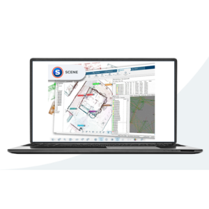
FARO® SCENE Software
Read More
![]()
FARO® Hardware Solutions
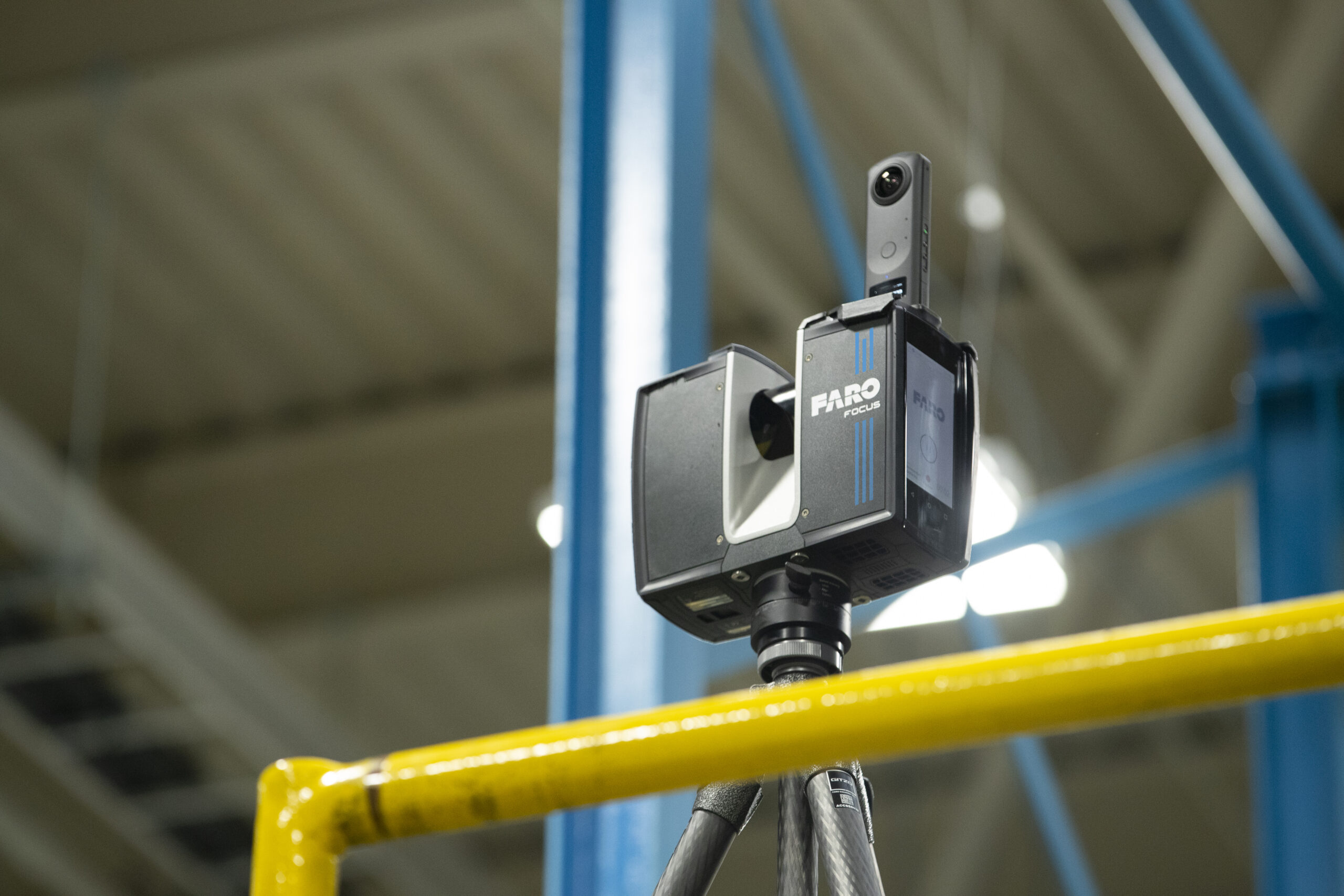
FARO® Orbis™ Mobile Scanners capture Quick Mobile Scans and Quality Flash Scans all in one device.
For best on-site data capture, Focus Orbisconnects with the new FARO Stream app, bridging FARO hardware to the FARO Sphere cloud environment. Users can also benefit from Hybrid Reality Capture™, powered by Flash Technology™.
Combining Speed, Versatility & Accuracy In One Quality Mobile andFlash Scanning Solution
- Fast Mobile Scans and Quality Flash Scans in One Device
- 10X Faster Than Other Surveying Methods
- Delivering Best-in-class SLAM
- Scanning Made Simple and Repeatable
- Indoor and outdoor capture capability
- Collaborative work share and existing software integration
- Wide range of capture modes
- Hybrid Reality Capture powered by Flash Technology for enhanced speed and accuracy
- Ability to manage large and complex projects with Hybrid Reality Capture
- Full-color Mobile and Flash scans
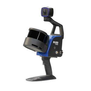
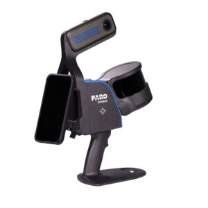
FARO® Orbis Premium Mobile Scanner combines speed, versatility, and accuracy in one fast 3D mobile hand-held scanning solution. This new model delivers higher resolution image and colorization quality. 10X Faster than traditional surveying methods, the increased capture speed saves time and money, prevents jobsite disruption, and allows real-time decision-making.
FARO® Orbis Mobile Scanner combines speed, versatility, and accuracy in one fast 3D mobile hand-held scanning solution. This hybrid system empowers you to streamline project workflows, minimize human error, and maximize productivity. 10X Faster than traditional surveying methods, the increased capture speed saves time and money, prevents jobsite disruption, and allows real-time decision-making.
Welcome to FARO Academy!
Learning and Resources. FARO Academy offers Tutorial Videos for mastering your groundbreaking FARO Technologies products.
https://learn.faro.com/login/index.php”
FARO Now!
Customer Portal – Your FARO Account, Product Licenses, Warranties, and Support Cases
Knowledge Base
The FARO Knowledge Base contains everything you need: user manuals, firmware and software downloads, how-to and troubleshooting guides, helpful videos and more.
https://knowledge.faro.com/Special:Userlogin
FARO Sphere
Hub for all data collected at a job site, accessible on your web browser in real time
https://www.farosphere.com/home/
Orbis Laser Scanners
FARO® Software Solutions
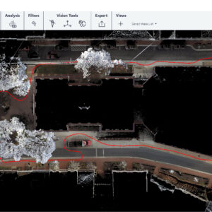
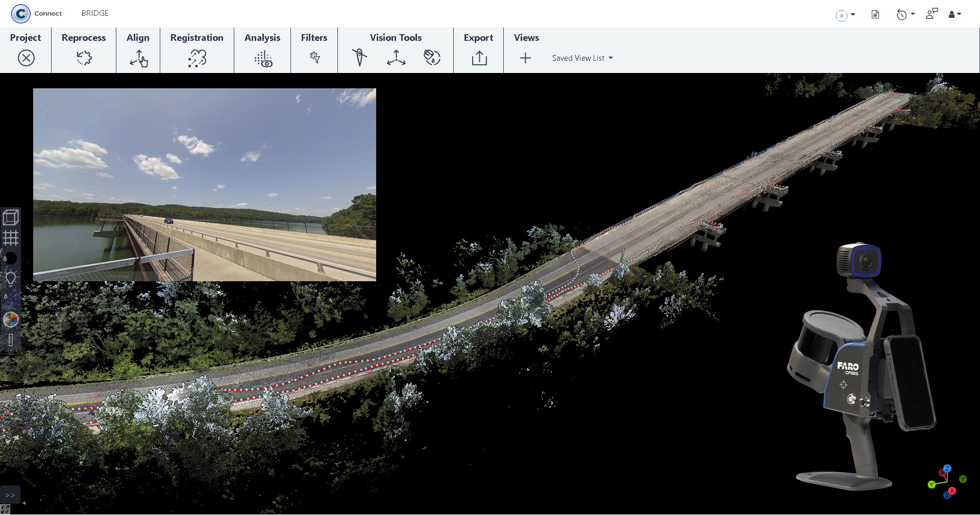
Discover the power of FARO Connect, the ultimate desktop solution for easy management of 3D point cloud and image data. Powered by GeoSLAM’s proprietary SLAM algorithm, Connect is the all-in-one software for local processing of FARO Orbis data with a connection to the optional FARO Sphere® XG cloud-based platform for viewing, sharing and collaborating.
Experience robust 3D visualizations through the data viewer and watch your digital replicas come to life, extracting immediate insights from your 3D point clouds. Enhance your data and make it clearer through a series of automated filters including outlier, noise, thinning and transient workflows. Additionally, employ automated workflows to optimize your data further, including change detection, and prepare your data for additional analysis with a wide range of export options.
Fast, accurate 3D point cloud capture, processing, and registration
- Local processing in FARO Connect safeguards data ownership
- Automatic Georeferencing uses reflective targets or control points in your workflow
- Automatic Point Cloud Data Filtering and Colorization
- Integrated camera on FARO Orbis captures panoramic images and achieves RGB colorization of your 3D point cloud data
- Minimize project costs by utilizing automated data processing and registration workflows
- Explore scan data in unmatched clarity and visual quality due to solid surface rendering and HDR colorization
- Fast and versatile scan data export
- Take, edit, and share measurements and add annotations, organize using categories and reference tags, or add links to external sources
- Import and export digital photos and panoramic images
- 3D point clouds or panoramic images are downloadable for direct use with Autodesk® Siemens, Bentley Point-tools portfolio, or any CAD and BIM software
- Download to-scale orthoimages for use in generating 2D deliverables
- Share and collaborate worldwide anytime, anywhere with Sphere XG
FARO® SCENE Software is the most intuitive and efficient software for scan data processing and registration. FARO® SCENE is designed for all FARO® scanning solutions and third-party laser scanners. It features automatic target recognition, scan registration, and validation, allowing users to generate high-quality data in full color quickly and conveniently.
FARO® Connect Software is the most intuitive and efficient software for scan data processing and registration. FARO® SCENE is designed for all FARO® scanning solutions and third-party laser scanners. It features automatic target recognition, scan registration, and validation, allowing users to generate high-quality data in full color quickly and conveniently.
FARO® Stream is the first mobile app that connects FARO® hardware with FARO® Sphere cloud-based applications and services. As a result, Stream makes on-site capture workflows more efficient and brings captured data directly into the FARO ecosystem, providing live feedback while performing pre-registration.
FARO® Sphere XG is a cloud-based information platform that provides the most efficient data exchange possible — including remote collaboration on 3D projects. Sphere offers a centralized, collaborative user experience across FARO® point cloud applications and service-oriented platforms through a secure, single-point sign-on (SSO) process.